

Directions and Maps
Summer Routes | Memorial Day to Thanksgiving
Stay on CR 131 until just past mile marker 42 (last place for gas by the way). You are going to travel about 400 meters north of the Sinclair Gas Station (you will be making a left going westsame side as gas station). You will have just passed a beige Colorado Department of Transportation building on your right.
You will not see a sign for CR 17. What you will see is a green sign saying turn right for Eagle Rock. YOU DO NOT TURN RIGHT. You make a left instead and that is CR 17. You should see a light blue sign once you turn onto the road that has a Columbine Flower on it and says Scenic Byway. At this point reset your tripometer to zero. You need to do this to make sure you are going far enough down the road for the next turn. If you do not reset your tripometer you could get confused on where to turn. You will be going almost exactly 6 miles down the road once you are on CR 17 which is entirely paved. After about 6 miles you are specifically looking for a brown sign that says turn left for Dunckley Pass. Now you will be on a gravel road. If you miss this turn and stay on the paved road you will eventually be back on 131 a few miles north of the town of Yampa.
You are going to continue on the gravel road for approximately 23 miles. You will come to the top of a mountain pass around mile marker 62 this is Dunckley Pass. You will continue watching the mile markers decrease as you go down the pass. You will come to a county road intersection about 10 miles down from Dunckley Pass. You will continue until you see mile marker 53. We are between mile marker 52 and 53 on the left or east side of the road. We have a large 4×8 sign that says Wild Skies at the end of the driveway. However, it is parallel to road so you will not see it until you arrive. If you hit mile marker 52 or see a sign on this last stretch that says welcome to the Routt Nat’l Forest you just passed it up.
Take I-70 to SR 13 (Rifle exit) north past Meeker. Approximately 30 miles north of Meeker is the town of Hamilton. County Road 317 ends at SR 13 so you can only take a right going east. Make sure to always keep the river on your right side if ever in doubt as to where to take a fork in the road. Your entire trip from this point the river will be on your right side.
About 12 miles of the road are paved and the remaining 6 miles or so are gravel. At the end of the road you will see a large ranch on the right (south side) called the “Motherwell” (sign on gate). It will have a distinct round green metal fence for over a mile. You will see a large boulder in an island at the fork in the road at this point. DO NOT go to Hayden. Take the lower road and fork right and head towards Trappers Lake. Make a right on the fork and keep the river on the right the rest of the way.
At this point reset your tripometer again to zero and only go another 2.5 miles on CR 29 and if it is visible, you will continue to keep the river on your right for the rest of the drive. You will see a red house with 7 mailboxes in front of it at the next fork. Take a right and you are now on CR 55. CR 55 turns into CR 19 when you switch counties again, but same road. From the mailboxes you have another 10 miles to go. You will hit a yield sign at the end of CR 19 and 50 yards ahead is the parking area. Please pay close attention to these directions as there is no easy place to turn around if you pass up a turn -especially pulling a snowmobile trailer.
You are going to continue on the gravel road for approximately 23 miles. You will come to the top of a mountain pass around mile marker 62this is Dunckley Pass. You will continue watching the mile marker decrease as you go down the pass. You will come to a country road intersection about 10 miles down from Dunckley Pass. You will continue until you see mile marker 53. We are between mile marker 52 and 53 on the left or east side of the road. We have a large 4×8 sign that says Wild Skies at the end of the driveway. However, it is parallel to road so you will not see it until you arrive. If you hit mile marker 52 or see a sign on this last stretch that says welcome to the Routt Nat’l Forest you just passed it up.
GPS coordinates are: 40.155524,-107.220855. Following the blue roads on the map below:
The only way to access the Flat Tops Cabin in the winter is through Hayden. Take County Road 53 from Hayden for about 14 miles. You will see a sign that says make a right turn to go to Hamilton and stay to the left of a large boulder in the middle of the road to go to Trappers Lake. YOU want Trappers Lake on the left. Please take this downhill fork on a curve slowly as it can ice up and be slippery.
You are technically on CR 29 now and from this point on you will keep the river on your right-assuming you can see it. At this point reset your tripometer again to zero and only go another 2.5 miles on CR 29. You will see a red house with 7 mailboxes in front of it at the next fork. Take a right and you are now on CR 55.
CR 55 turns into CR 19 when you switch counties again, but same road. From the mailboxes you have another 10 miles to go. You will hit a yield sign at the end of CR 19 and 50 yards ahead is the parking area. Please pay close attention to these directions as there is no easy place to turn around if you pass up a turn -especially pulling a snowmobile trailer. DO NOT GO UP THE STEEP HILL.
DO NOT GO PAST THE ROAD CLOSED SIGNS UNLESS WE HAVE INSTRUCTED YOU TO DO SO-YOU WILL GET YOUR VEHICLE STUCK IN THE SNOW!
Please call the cabin at 970.276.4868 from here as it is the last place your cell phone will work for the rest of the trip. If coming from Utah or our cabins in Craig, CO, make a right going south on SR 13 (taking a right on SR 13 sends you towards Meeker). If you are coming from Steamboat or east of Craig you will make a left on SR 13 headed south towards Meeker, CO.
You will be on SR 13 for about 14 miles. Set your tripometer to zero and pay attention as some folks are taking in the scenery and don’t pay attention. You will be in the little town of Hamilton population 60 – so easy to miss. You will see a road sign saying make a left onto CR 317 (this is about 14 miles from Craig. Rest your tripometer to zero again and stay on 317 (will switch counties and will be called CR 29 but same road). DO NOT turn at Wyman’s Angus sign.
Stay until you are about 18 miles down the road and see the Motherwell Ranch with about 1 mile of green metal fence. You will hit a fork in the road and a big rock in the middle of the road. The sign will say go left for Hayden or right for Trappers Lake. Make a right on the fork and keep the river on the right the rest of the way. At this point reset your tripometer again to zero and only go another 2.5 miles on CR 29 and if it is visible, you will continue to keep the river on your right for the rest of the drive until you merge onto CR 8 at the yield sign.
At the next fork, you will see a red house with 7 mailboxes in front of it. Take a right and you are now on CR 55. CR 55 turns into CR 19 when you switch counties again, but same road. You will hit a yield sign at the end of CR 19. Make a hard right and you are on CR 8. Reset your tripometer to zero and you will go another 2.5 miles to our place. About 200 yards down the road the river will go under the road. You will see the mile markers going down from 54 to 53. We are 52100 so if you hit mile marker 52 you just passed us up. We will have a sign at the end of our driveway that says Wild Skies. It is parallel to the road so you will not see it until you get to our driveway. If you see a sign that says Welcome to the Routt National Forest you just passed us up.
You will be on SR 13 for about 14 miles. Set your tripometer to zero and pay attention as some folks are taking in the scenery and don’t pay attention. You will be in the little town of Hamilton population 60 – so easy to miss. You will see a road sign saying make a left onto CR 317 (this is about 14 miles from Craig. Rest your tripometer to zero again and stay on 317 (will switch counties and will be called CR 29 but same road). DO NOT turn at Wyman’s Angus sign. Stay until you are about 18 miles down the road and see the Motherwell Ranch with about 1 mile of green metal fence. You will hit a fork in the road and a big rock in the middle of the road. The sign will say go left for Hayden or right for Trappers Lake. Make a right on the fork and keep the river on the right the rest of the way. At this point reset your tripometer again to zero and only go another 2.5 miles on CR 29 and if it is visible, you will continue to keep the river on your right for the rest of the drive. You will see a red house with 7 mailboxes in front of it at the next fork. Take a right and you are now on CR 55. CR 55 turns into CR 19 when you switch counties again, but same road. From the mailboxes you have another 10 miles to go. You will hit a yield sign at the end of CR 19 and 50 yards ahead is the parking area. Please pay close attention to these directions as there is no easy place to turn around if you pass up a turn -especially pulling a snowmobile trailer.
Please call us once you leave Steamboat at 970.276.4868. Go west on Hwy 40 (aka Lincoln, St. in Steamboat) until the town of Hayden, CO (about 30 minutes west). Please call us at the cabin (970.276.4868) to let us know you are in Hayden. Your cell phone will stop working within a few miles. At the only stop light in Hayden make a left going south (stoplight will have a sign saying fairgrounds to the left). There is a small street corner sign on the right NE corner saying Poplar Street but easy to miss. This road is also known as County Road 53. You will drive a couple miles through a residential area and then you will see the CR 53 sign. From Hayden you will drive for about 14 miles until you will see a sign that says make a right turn to go to Hamilton or go left for Trappers Lake. Stay to the left of a large boulder in the middle of the road to go to Trappers Lake. YOU want Trappers Lake on the left. Please take this downhill fork on a curve slowly as it can be slippery if wet.
You are technically on CR 29 now and from this point on you will keep the river on your right-assuming you can see it. At this point reset your tripometer to zero and only go another 2.5 miles on CR 29. You will see a red house with 7 mailboxes in front of it at the next fork. Take a right and you are now on CR 55.
CR 55 turns into CR 19 when you switch counties again, but same road. From the mailboxes you have another 12.5 miles to go. You will hit a yield sign at the end of CR 19. Make a sharp right and you are now on CR 8. You will see the river go under the road in about 200 yards. You will also see the mile markers go from 54 to 53 …. We are at 52100 so if you see mile marker 52 you passed us up. Also if you see a Welcome to the Routt National Forest sign you have passed us up. We do have a sign at the end of our driveway that says Wild Skies. However, it is parallel to the road so you will not see it until you are right on it.

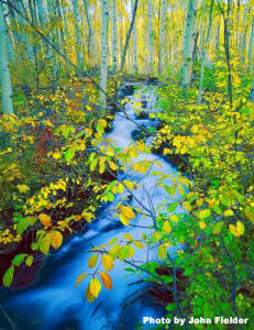
We are located in Northwestern Colorado, inside game management unit 12 (GMU 12), which is centrally located between Meeker, Craig, Hayden, Steamboat Springs, and Yampa on the Flat Tops Scenic Byway at 52100 County Road 8 between mile markers 52 and 53 (next door to the National Historic Landmark Pyramid Ranger Station) and in the heart of the largest elk herd in the world (39,000+ animals) which is located in the Flat Tops Wilderness of NW Colorado. We strongly encourage the use of four wheel drive vehicles in case you decide to travel back country roads that can get muddy and slick after a rainstorm.
Our GPS Coordinates are: 40.155524,-107.220855
Hayden / Steamboat (HDN)
DIRECTIONS
Hayden/Steamboat/Yampa Regional (HDN) is the smallest but most convenient and services Steamboat Springs. It’s about a 45 minute drive. Denver (DEN) is the nearest major airport but is a 4 hour drive. Grand Junction (GJT) is the next largest with a roughly 2.5 hour drive.
Denver (DEN) is the nearest major airport (4 hour drive)
DIRECTIONS
but don’t forget about these smaller, convenient airports when searching for low air fares:
Grand Junction(GJT)
DIRECTIONS
Eagle County / Vail (EGE)
DIRECTIONS
Direct flights to Steamboat are available from these major cities:
ATLANTA (ATL)
Daily Flights on Delta
December 20 – March 29
CHICAGO (ORD)
Daily Flights on American
December 18 – April 6
Saturday & Sunday Flights on United Express
December 20 – April 5
DALLAS/FT. WORTH (DFW)
Daily Flights on American
December 18 – April 6
Saturday Flights on American
December 20; January 10 – March 28
DENVER (DEN)
Daily Flights (3x) on United Express
November 26 – April 12
HOUSTON (IAH)
Daily Flights on United
December 18 – April 6
Wednesday Flights on United
January 1 – February 11
Saturday Flights on United
December 20 – April 5
LOS ANGELES (LAX)
Mon/Thur/Sat/Sun Flights on United Express
December 18 – March 23
MINNEAPOLIS/ST. PAUL (MSP)
Daily Flights on Delta Connection
December 20 – March 29
NEWARK (EWR)
Saturday Flights on United
December 20 – April 4
SAN FRANCISCO (SFO)
Saturday Flights on United Express
December 20 – March 21
SEATTLE (SEA)
Wed/Sat/Sun Flights on Alaska Airlines
December 17 – March 29
WASHINGTON DULLES (IAD)
Saturday Flights on United
December 20 – January 3
January 31 – April 4
Commuter flights fly regularly from (HDN) to Denver (DEN), so if you cannot find a direct flight to (HDN) from your city, you can always arrange for a flight from DEN to HDN and avoid winter mountain driving conditions from Denver.
CONTACT US
If you have questions or would like to check availability, call 970.926.0216 or complete the form below.